This article contains affiliate links. If you make a purchase through these links, we may earn a small commission at no extra cost to you. Learn more.
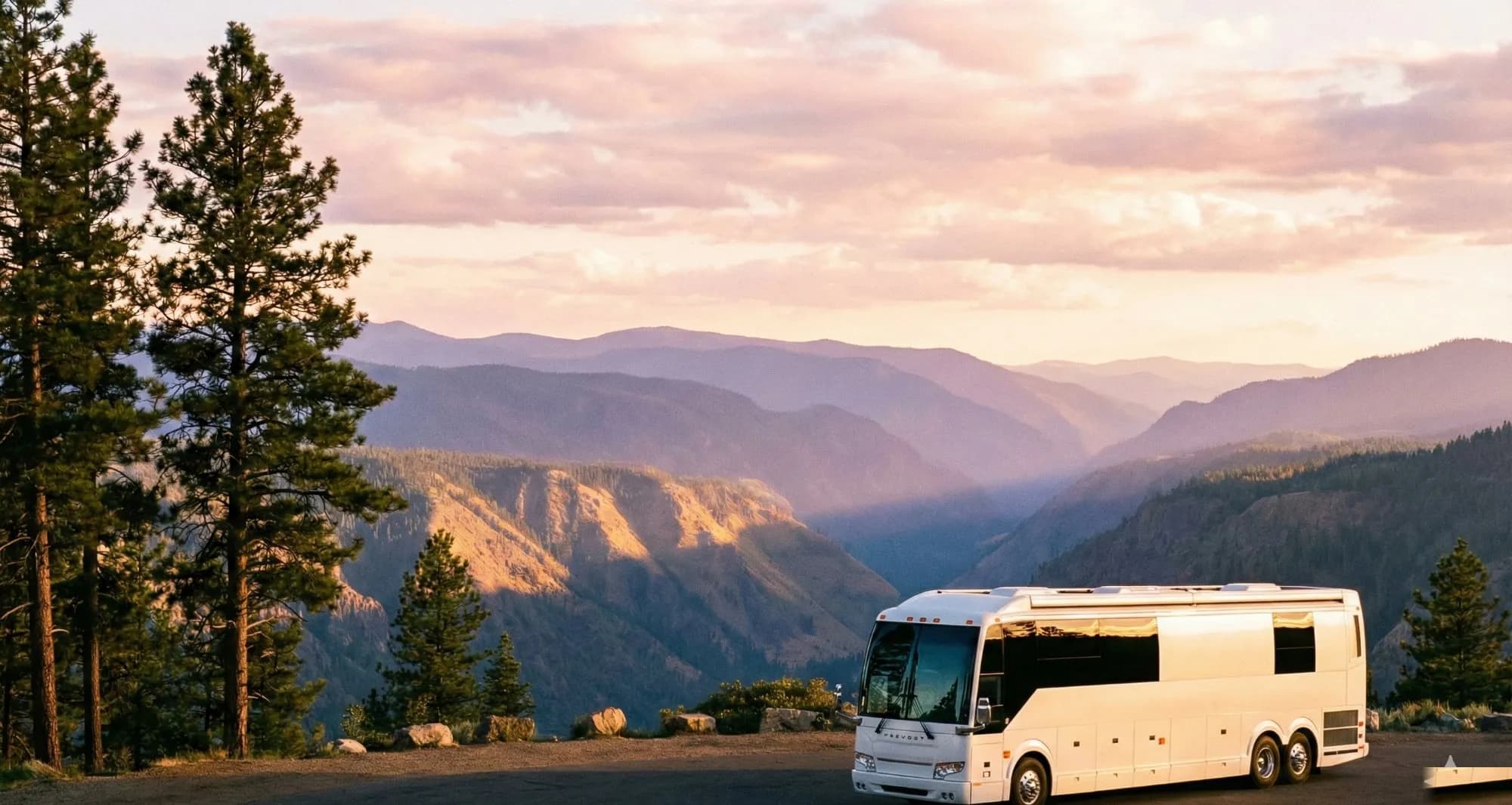
There are RV trips, and then there's the Pacific Northwest. In two weeks you can drive from old-growth rain forests where trees are 500 years old to volcanic peaks still steaming from their last eruption, then down 400 miles of coastline where sea stacks rise 300 feet from the surf. No other route in the lower 48 packs this much visual variety into a single loop.
This 14-day route covers the Olympic Peninsula, the Washington coast, the Columbia River Gorge, the Oregon coast, and Crater Lake — roughly 2,000 miles of driving, with campgrounds identified at each stop. We've split it for flexibility: you can do the full loop or break it into the Washington half and the Oregon half as separate trips.
The Route at a Glance
Start: Seattle (or Tacoma — same practical distance to the ferry). The loop runs counterclockwise: Olympic Peninsula → Hoh Rain Forest → Kalaloch → Astoria → Oregon Coast → Crater Lake → Cascades → Mount Rainier → back to Seattle. If you're flying in and renting an RV, Seattle and Portland both have multiple rental companies.
RV size notes: Most campgrounds on this route accept rigs up to 35-40 feet. Some Hoh Rain Forest sites have a 21-foot limit on certain loops. Hurricane Ridge in Olympic National Park is a challenging drive for anything over 25 feet — leave the rig at the valley campground and drive up in the tow vehicle. Crater Lake's Mazama Campground accepts large rigs with no issues.
Days 1–3: Olympic Peninsula — Rain Forests and Sea Cliffs
Cross Puget Sound on the Washington State Ferry from Edmonds to Kingston ($16-20 for a standard-size RV) and you're on the Olympic Peninsula within the hour. The ferry is the start of the trip experience — you're immediately in a different Pacific Northwest pace of life, away from I-5's chaos.
Head west on US-101, which wraps entirely around the Olympic Peninsula and accesses nearly every major park feature. Your first major stop is Hurricane Ridge in Olympic National Park — 5,242 feet, panoramic views of the Olympic Mountains, and the occasional mountain goat on the ridge trail. Leave the rig at Heart of the Hills Campground (7 miles below the ridge, sites accept up to 21 feet on some loops, 35 feet on others — call ahead) and drive up in the tow vehicle.
The Hoh Rain Forest deserves a full day. One of only a handful of temperate rain forests in North America, the Hoh gets 140 inches of rain per year and produces a landscape that looks genuinely prehistoric: 500-year-old Sitka spruces draped in hanging mosses, nurse logs supporting entire ecosystems, Roosevelt elk wandering through like they own the place (they do). The Hall of Mosses Trail (0.8 miles) is one of the most photographed walks in the state. The Hoh Campground accepts RVs up to 21 feet — if you're larger, base camp at Kalaloch Campground (10 miles south on US-101, accepts up to 35 feet) and drive the Hoh section in the tow vehicle.
Kalaloch Lodge and Campground sits on a bluff above the Pacific with direct access to some of the most dramatic Pacific coast beaches in Washington. The numbered beaches — Beach 1 through Beach 4 — are accessible via short trails and offer tide pools, driftwood fields the size of log yards, and the sense that you're standing at the edge of the continent. Camp here nights 2 and 3.
Days 4–5: La Push and the Quileute Coast
La Push — the small Quileute Tribe community on the coast — is one of the most otherworldly sections of the Washington coast. The sea stacks at First Beach rise from the surf like sentinels, often surrounded by bald eagles and harbor seals. Second Beach and Third Beach require short hikes (1-2 miles each way) and are even more dramatic. The campground at Mora (3 miles from La Push) accepts up to 35 feet and fills fast in summer — in late March and April it's manageable. The town of Forks (15 miles inland) has the nearest fuel, groceries, and services.
Spend Day 5 making your way south along US-101 through Quinault Rain Forest (another temperate rain forest worth a stop — the world's largest Sitka spruce is here) and down to the Washington coast's open dune beaches. Lake Quinault Lodge is worth stopping for coffee and a look at the building — a 1926 National Park lodge that's held up remarkably well.
Days 6–7: Astoria and the Columbia River Gorge
Cross into Oregon at the Astoria-Megler Bridge — a 4.1-mile steel through-truss bridge that carries US-101 over the mouth of the Columbia River. It's one of the most dramatic bridge crossings you'll make in an RV, and entirely fine in any rig size. Astoria is the oldest American city west of the Rockies and genuinely interesting: the 125-foot Astoria Column on Coxcomb Hill gives a panoramic view of the Columbia meeting the Pacific. Downtown has excellent seafood, a Victorian commercial district, and the Columbia River Maritime Museum (the best museum on the coast).
Kampgrounds of America in Astoria is well-positioned for a two-night base camp. Day 7 drives the first section of the Oregon coast south — Cannon Beach (Haystack Rock is unmissable, one of the most famous sea stacks in the world), Manzanita, Tillamook (the cheese factory is genuinely worth a stop), and the Three Capes Scenic Drive. Cape Lookout State Park Campground has excellent sites with ocean-facing views and accepts rigs up to 60 feet.
Days 8–10: Oregon Coast — Lincoln City to Bandon
The central and southern Oregon coast is where the scenery gets even more dramatic. Lincoln City's outlet mall is a trap that will cost you half a day if you're not careful. The Siletz Bay at sunset is not. Devils Punchbowl near Newport is a collapsed sea cave that creates a natural rock bowl — spectacular at high tide when the surf surges through the tunnels.
Newport is the essential Oregon coast stop: the Oregon Coast Aquarium (genuinely excellent, not touristy — the coastal birds exhibit is remarkable), the Hatfield Marine Science Center, and the fresh Dungeness crab at the bayfront docks. If you eat one meal on this trip at a restaurant, it's Dungeness crab in Newport in the spring.
From Newport south: Florence and the Oregon Dunes — 40 miles of the largest coastal sand dunes in North America, accessible for OHV use in some areas and scenic drives in others. Shore Acres State Park near Coos Bay has formal gardens perched on a clifftop above the Pacific that look completely incongruous and completely stunning. Bandon at the end of Day 9 or 10 is the turnaround point for the coast — the beach rock formations here (Face Rock, Coquille Point) are some of the most photographed in Oregon. Bullards Beach State Park Campground in Bandon is excellent for large rigs.
Day 11: Crater Lake
Turn inland from Bandon on OR-42, then north and east to reach Crater Lake. The drive takes most of a day. Crater Lake National Park is the deepest lake in the United States (1,943 feet), formed from the collapse of Mount Mazama after a volcanic eruption 7,700 years ago. The water is an impossible shade of blue — ultramarine so saturated it looks photoshopped — and the rim road offers 33 miles of continuous lake views.
Mazama Village Campground (inside the park, south rim) accepts RVs up to 50 feet and is one of the better national park campgrounds in the system. Sites fill 6 months in advance for summer — in late May through early June (shoulder season), availability opens up significantly. The park typically receives heavy snow through April, so a late-May timing for this section is ideal. Rim Drive opens when snow clears, usually late June — if you're visiting in spring, the south rim views are accessible but the full loop won't be.
Days 12–13: Cascades and Mount Rainier
Drive north from Crater Lake through the Oregon Cascades on US-97, one of the most underrated drives in the Northwest: volcanic landscape, high desert plateau, the Three Sisters peaks in the background. Stop at Dee Wright Observatory near McKenzie Pass (a lava field so recent — 1,500 years — that nothing has grown on it yet) if you're visiting when the road is snow-free.
Cross into Washington and make your way to Mount Rainier National Park. At 14,411 feet, Rainier is the most topographically prominent mountain in the lower 48 — it creates its own weather and is visible from Seattle, 60 miles away, on clear days. The Nisqually entrance to the park leads to Paradise (5,400 feet), which has the best close-up views of the mountain and some of the best hiking in the Northwest. Cougar Rock Campground (4 miles below Paradise) accepts RVs and is a good base camp for exploring the park.
Day 13 is for the mountain: the Skyline Trail loop from Paradise (5.5 miles, 1,400 feet gain) takes you above tree line with 360-degree views of the Cascades and, on clear days, Mount Adams and Mount St. Helens to the south. In spring (April-May), the trail may still have snow — microspikes recommended, available at the Visitors Center.
Day 14: Return to Seattle
A leisurely 2-hour drive from Rainier back to Seattle, via WA-7 and I-5. If the timing works, the Tuesday Farmers Market at the University District or the Pike Place Market are worth a last morning stop before returning the rig or heading to the airport.
Campground Summary
Heart of the Hills (Olympic NP, WA): $30/night, no hookups, accepts 35 ft on some loops. Kalaloch (Olympic NP, WA): $30-35/night, no hookups, accepts 35 ft, ocean bluff location. Mora (Olympic NP, WA): $30/night, no hookups, 35 ft max. Cape Lookout State Park (OR): $30-35/night, hookup sites available, accepts 60 ft. Bullards Beach State Park (OR): $28-35/night, hookup sites, accepts large rigs. Mazama Village (Crater Lake NP, OR): $25-30/night, no hookups, accepts 50 ft. Cougar Rock (Mount Rainier NP, WA): $30/night, no hookups, accepts 35 ft.
Best Time to Go
Late May through September is the sweet spot. June and July offer the best combination of dry weather, open roads (Crater Lake Rim Drive typically opens by late June), and long daylight hours. August is peak season and the most expensive. Late September has fall colors beginning in the Cascades and significantly fewer crowds. April and May are possible but expect snow at elevation and some park roads still closed. If crowd avoidance is a priority: late May and early September are the windows when conditions are excellent and the summer rush hasn't fully arrived or has just cleared.
Ready to Plan Your Trip?
Put this knowledge to work. Let our AI build a personalized RV itinerary for your next adventure — or browse community trips for inspiration.